Chitgar Flood Collecting Pipelines and Detention Basin
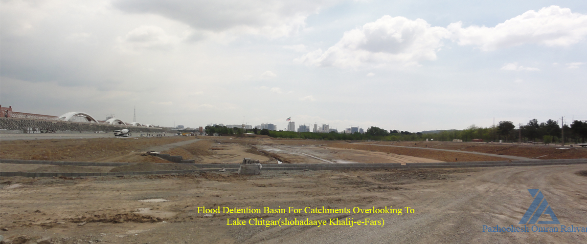
Chitgar Flood Detention Basin is located south of Lake Chitgar (Shohadaaye Khalij-e-Fars) in north of Chitgar Park. The basin receives and controls surface runoffs and floods from Tehran west area and catchments overlooking to Lake Chitgar through tweo concrete pipelines (B1 and B2). Considering big volume and high discharge of surface runoffs and floods flowing into pipeline B3 and, on the other hand, limited capacity of sewer system in Tehran Zone 21 (maximum discharge capacity is limited to 1.5 cms prior to construction of Dastvareh Canal), a flood detention basin is anticipated upstream of pipeline B3 in order to control and attenuate the inflowing flood into the pipeline.
The basin covers an overall area of more than 5 hectares and its effective and operational depth is 4.5 meters. Its reservoir area at planned operational elevation is about 3.5 hectares. The reservoir volumes at weir crest and maximum operational elevations are about, respectfully, 96 and 130 thousand cubic meters. Peak discharges of 50- and 100-year inflowing floods into the basin are, respectfully, 44.66 and 59.46 cubic meters per second, and their corresponding volumes are about, respectfully, 184 and 237 thousand cubic meters. The flood leaves the basin through a 10-m wide free overflow ogee weir and a small bottom sluice gate. The attenuated outflow peak discharge for 50- and 100-year floods are, respectfully, 11.6 and 16.6 cubic meters per second.
-
Specifications of Pipelines inflowing into the Flood Detention Basin
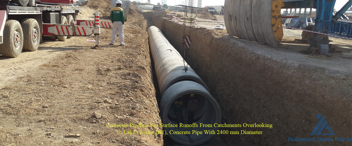
| Lake Chitgar West Collector (B1) | Concrete Pipe with 2,400mm diameter |
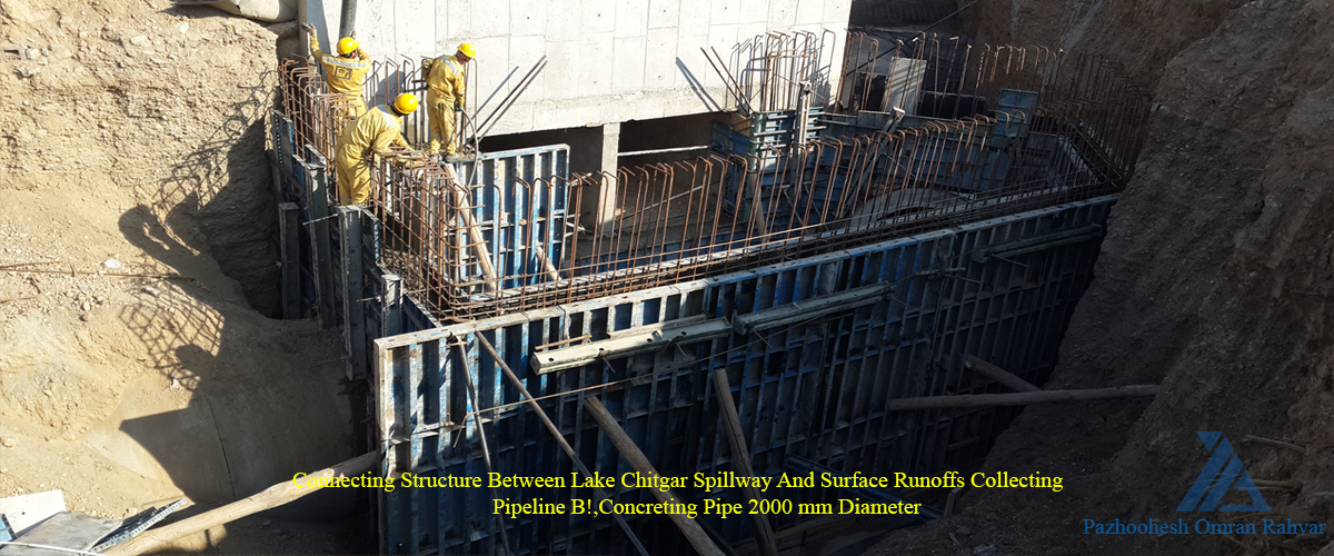
| Lake Chitgar East Collector (B2) | Concrete Pipe with 2,000mm diameter |
-
Geometric Specifications of the Flood Detention Basin
| Earth Work (cut): | 220,000 m3 |
| Basin Area at Maximum Operational Elevation (1258m): | 3.5 ha |
| Depth at Weir Crest Elevation (1257m): | 3.5 m |
| Maximum Operational Depth: | 4.5 m |
| Reservoir Volume at Weir Crest Elevation (1257m): | 96,000 m3 |
| Reservoir Volume at Maximum Operational Elevation (1258m): | 129,500 m3 |
-
Hydraulic Specifications of the Flood Detention Basin
| Weir Type | Free Overflow Ogee |
| Weir Crest Length | 10 m |
| Weir Crest Elevation | 1257 m |
| 50-year Inflowing Flood Volume | 184,400 m3 |
| 100-year Inflowing Flood Volume | 236,900 m3 |
| 50-year Inflowing Flood Peak Discharge | 44.66 m3/s |
| 100-year Inflowing Flood Peak Discharge | 59.46 m3/s |